
Panama Canal map: the route in one picture
The canal connects the Atlantic and the Pacific across Panama. It is about 50 miles (80 km) long. It is not a sea level cut. Ships are lifted in locks to Gatún Lake, which sits about 85 feet (26 m) above sea level, cross the lake and are lowered again on the other side. The 26 m is the height of the lake, not a constant height difference between the two oceans.
The map shows the locks, the lakes and the ports. Use it with the list below to follow a ship from one ocean to the other.
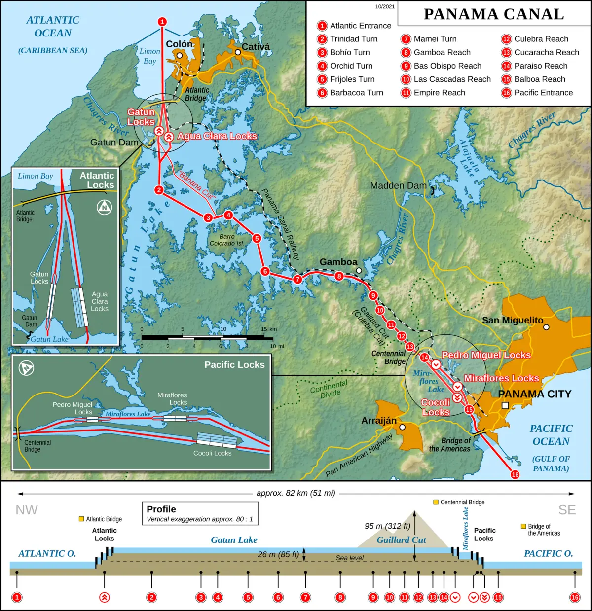
All Panama Canal locks
Three original lock complexes and two from the expansion.
| Lock | Side | Route | Type | Can you visit? |
|---|---|---|---|---|
| Miraflores | Pacific | Original | Locomotives | Yes, visitor center |
| Pedro Miguel | Pacific | Original | Locomotives | From a boat on a partial transit |
| Gatún | Atlantic | Original | Locomotives | Yes, via the Agua Clara ticket office |
| Cocolí | Pacific | Expanded | Tugs | – |
| Agua Clara | Atlantic | Expanded | Tugs | Yes, visitor center |
Miraflores and Agua Clara have visitor centers. For Gatún, the canal authority offers access with a ticket bought at the Agua Clara ticket office. For Pedro Miguel and Cocolí no visitor access is listed. A partial transit by boat takes you through Miraflores, Pedro Miguel and the Culebra Cut.
The route, lock by lock
From the Pacific to the Atlantic.
Original route
Pacific entrance, then Miraflores Locks, Miraflores Lake, Pedro Miguel Locks, the Culebra Cut, Gatún Lake, Gatún Locks and the Atlantic. A ship uses all three original lock complexes in this order.
Expanded route
The new route uses Cocolí on the Pacific side and Agua Clara on the Atlantic side. A ship on this route does not go through Miraflores, Pedro Miguel or Gatún. It still crosses Gatún Lake.
Not a chain of five
No ship passes all five lock complexes one after another. Each ship takes either the original or the expanded route.
Culebra Cut
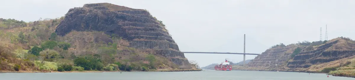
This is the cut between Pedro Miguel and Gatún Lake. A boat trip on a partial transit goes through it and passes the Centennial Bridge.
Panama Canal tours and lock visits
See the locks from the shore or from a boat, with live prices and availability.
How the Panama Canal locks work
A lock is a chamber with gates at both ends. A ship enters, the gates close behind it, and the water level in the chamber is changed until it matches the next level. Then the front gates open and the ship moves on. The same steps lift a ship up to Gatún Lake and lower it again on the other side.
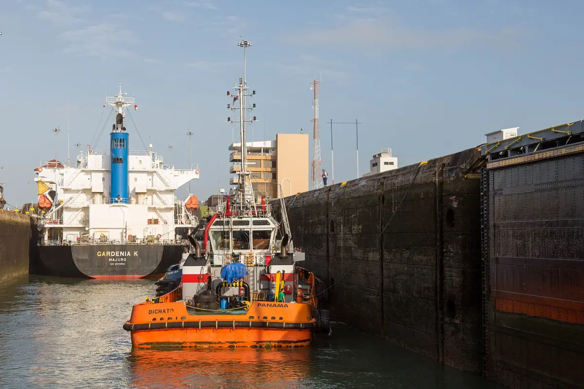
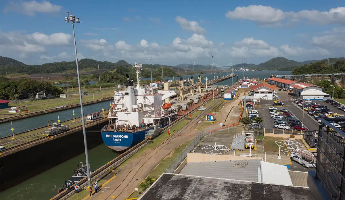
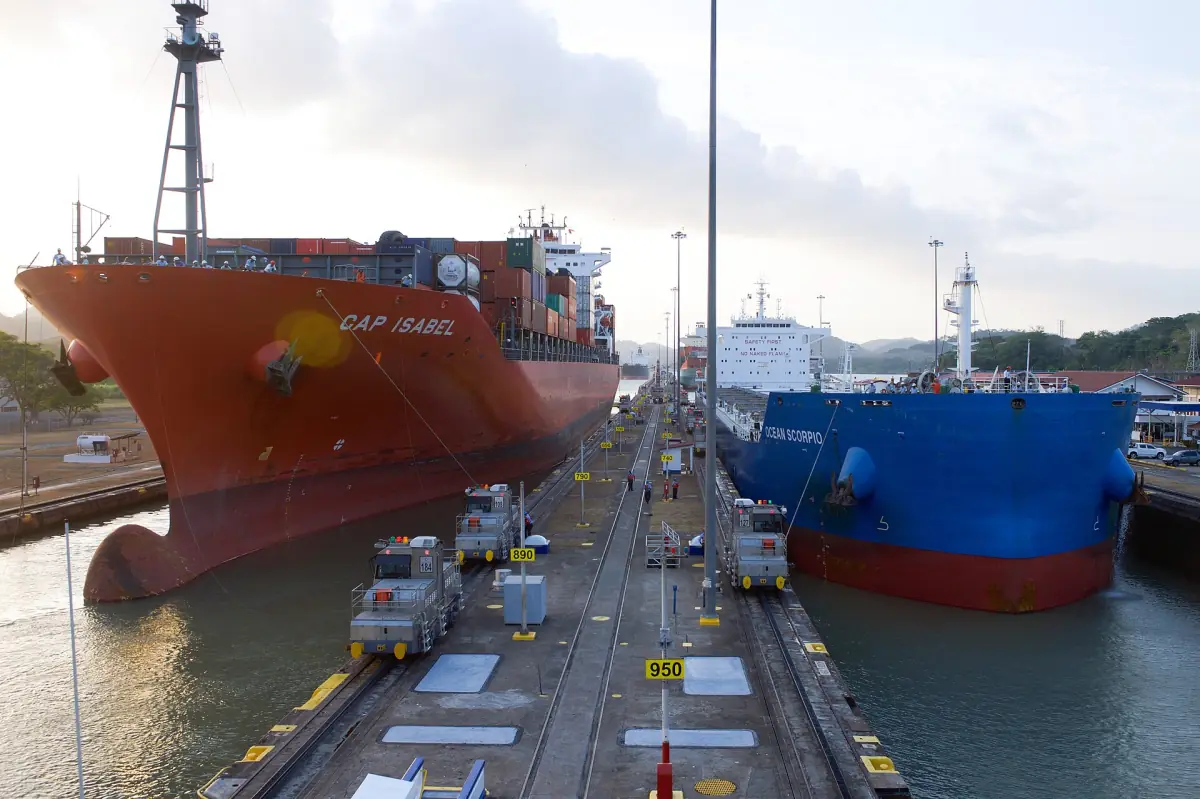
In the original locks, locomotives on the lock walls hold the ship in the middle of the chamber. In Cocolí and Agua Clara, tugs do this work. That is why you see both in photographs and why the two kinds of lock look different.
The canal depends on rain in its watershed. This is why low rainfall leads to limits on ships, as explained below.
The expansion of 2016
Agua Clara and Cocolí opened on 26 June 2016. They give the canal a third lane for larger ships. The original locks were not replaced and are still in use. This is the reason there are two routes on the map.
The new locks use tugs instead of locomotives. The history of the project is on the history page.
Water, draft limits and daily transits
The limits have changed several times. The latest known state is from 28 September 2026.
| Date | Measure | Status |
|---|---|---|
| December 2023 | 22 daily transits, 24 from 16 January 2024 | Past, drought period |
| August 2024 | Draft back to 50 feet (15.24 m), 36 slots from 1 September 2024 | Past, recovery |
| September 2026 | Draft cut to 48 feet (14.63 m) from 2 September, 47.5 feet (14.48 m) from 1 October announced | Replaced |
| From 15 October 2026 | 33 slots a day, 10 of them Neopanamax, draft 49 feet (14.94 m) | Latest known, until further notice |
The canal authority says the water deficit remains and that ships without a reservation can face delays. The old figures show how the situation developed, but they are not the current state. Do not assume today's limits from them.
For visitors, this does not mean closed locks. A limit on draft or slots does not by itself cancel a boat tour or a cruise. See cruises and the visitor centers for what to check.
Plan the rest of your trip
More pages about the canal.
Panama Canal map and locks: frequently asked questions
How long is the Panama Canal?
About 50 miles (80 km) between the Atlantic and the Pacific.
How many locks does the canal have?
Five lock complexes: Gatún on the Atlantic side, Pedro Miguel and Miraflores on the Pacific side, plus Agua Clara and Cocolí from the 2016 expansion.
Does a ship go through all five locks?
No. A ship uses either the three original lock complexes or the two expanded ones, not all five in a row.
How high does the canal lift a ship?
To Gatún Lake, which is about 85 feet (26 m) above sea level. This is not a constant height difference between the oceans.
How long does a transit take?
A ship needs 8 to 10 hours on average. A tourist day trip is a different product and has its own schedule.
Is the canal affected by low water?
Yes. From 15 October 2026 it allows 33 transits a day and a maximum Neopanamax draft of 49 feet (14.94 m). The canal is not closed.